Research
Vision Statement
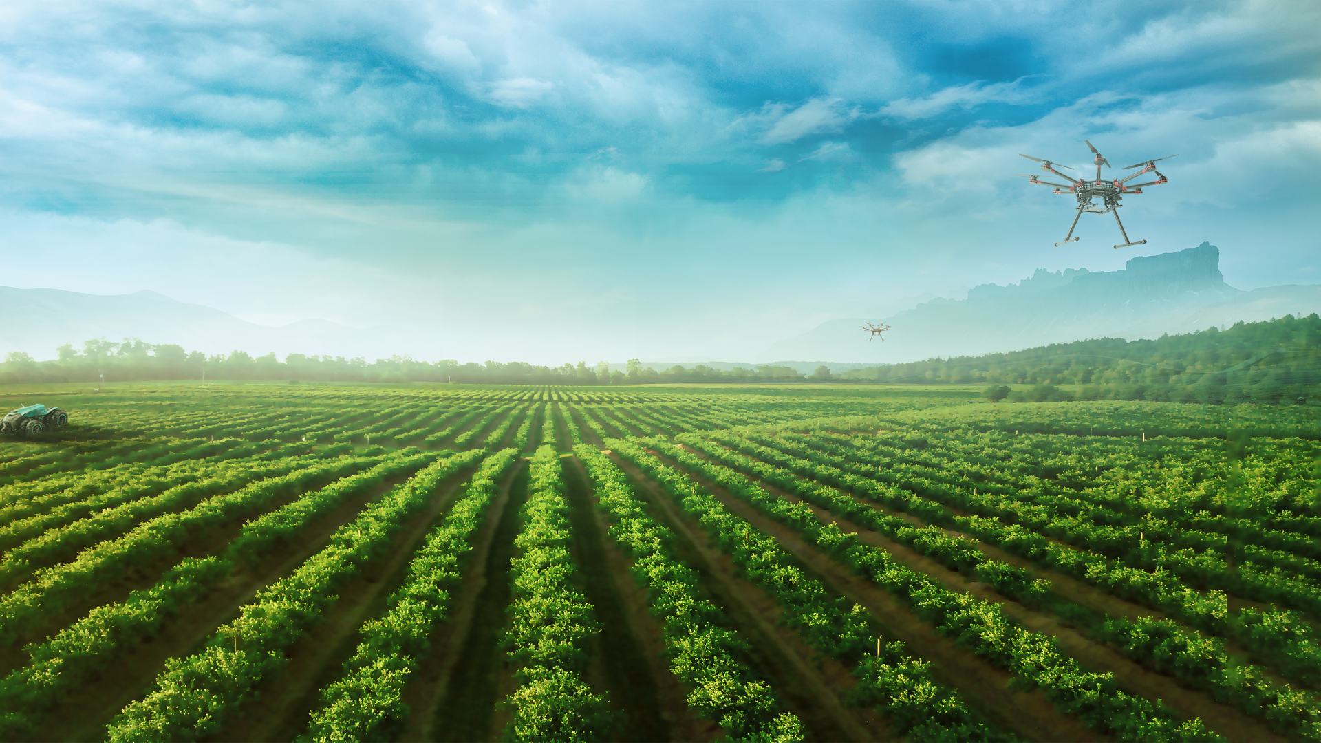
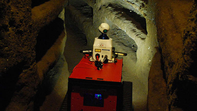
Rooted in mathematics, geodesy represents a highly interdisciplinary science, with applications to understanding risks to society and to developing sustainable pathways for human development. At IGG, we focus on using geodetic data for assessing climate change and monitoring the environment (including defining a global reference system), on land use management, property markets, urban planning, and ecosystem services assessment, and on developing sensor systems that aid precision agriculture and robotic systems research.
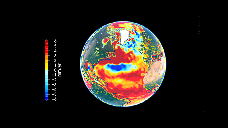
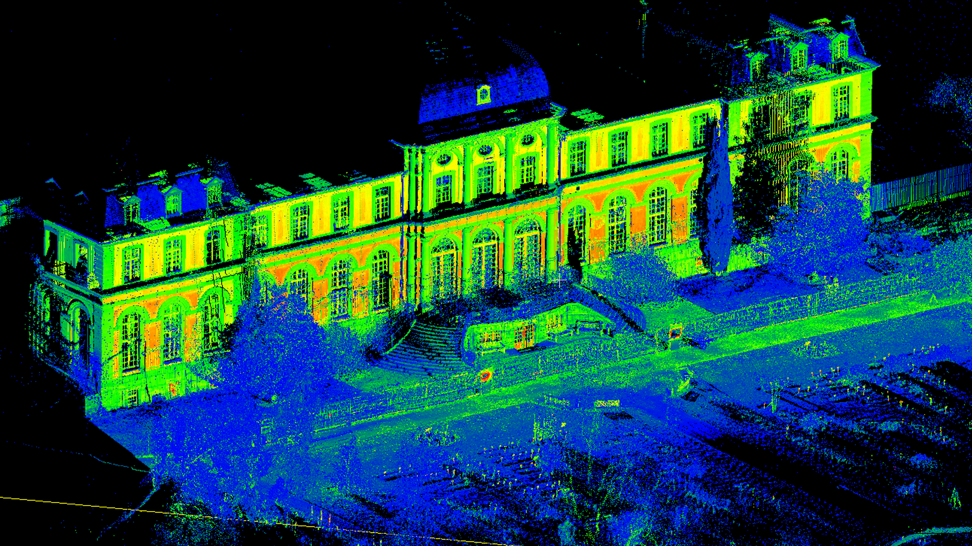
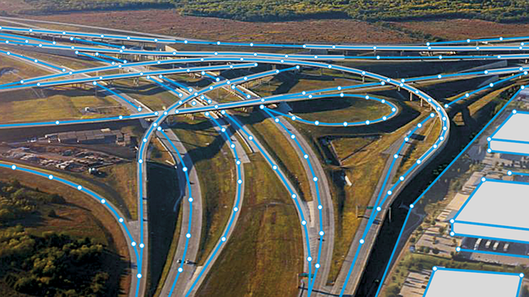
Sources of information that we analyze reach from dedicated gravity satellites such as GRACE and GRACE-FO, radar altimeters, multi- and hyperspectral remote sensing satellites, multi-GNSS, aerial, UAV- and vehicle-based sensors, and terrestrial instrumentation such as cameras and laser scanning. These geodetic data allow constructing space-time surface reconstructions at various scales that are used e.g. in sea level research, in the mapping of regional land subsidence or in plant phenology mapping, and deriving gravity field and mass change models, which in turn inform numerical simulation models. They enable digital representations of the man-made environment, such as building models and road network models, optimizing land use and decision making, and allowing us to optimize sensor networks and to operate autonomous systems and developing systems that allow for the visualization of and the interaction with geoinformation, such as geographic information systems and location-based services.
With today’s ubiquity of space-borne, airborne and UAV-based sensors, and with terrestrial sensor networks, the quality and quantity of data has dramatically increased, transforming geodesy and geoinformation science into a big data challenge. At IGG, we pursue the development of novel data analysis methods, optimization methods, machine learning approaches, and multi criteria assessment methods as well as decision support instruments for solving problems relevant to society.
Direct links to the research pages of the working groups
Astronomical, Physical
und Mathematical Geodesy
Geodesy
Geoinformation

Photogrammetry &
Robotics

Urban Development
and Landuse Planning
