Funded Projects
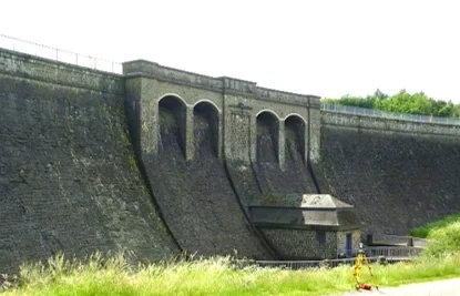
TLSDefo - Deformation Analysis Based on Terrestrial Laser Scanner Measurements
DFG Research Unit FOR 5455 (2023 – 2026)
Spokesperson: Prof. Dr.-Ing. Heiner Kuhlmann
www.tlsdefo.de
Within geodetic deformation analyses, we statistically test geometric changes of two or more object states. A rigorous assessment of significance is needed to separate between actual geometric changes and the uncertainty influences of measurement procedures and data processing methods. Within the current state of the art, the deformation analysis rests upon point-based measurements, acquired by e.g. total stations, Global Navigation Satellite Systems (GNSS) or extensometers. The preselection of these individual points, that should characterize the object, falls into the responsibility of the engineer. In general, this selection demands interdisciplinary collaboration. After analyzing the movement of these individual points, the movement of the complete object is gained by a spatial generalization process. This research unit aims at developing a methodology for a multi-scale, area-wise, statistical deformation analysis based on TLS. Area-wise deformation does not rely on the decisions on where to place individual monitored points and, therefore, shows the possibility to detect non-expected deformations.
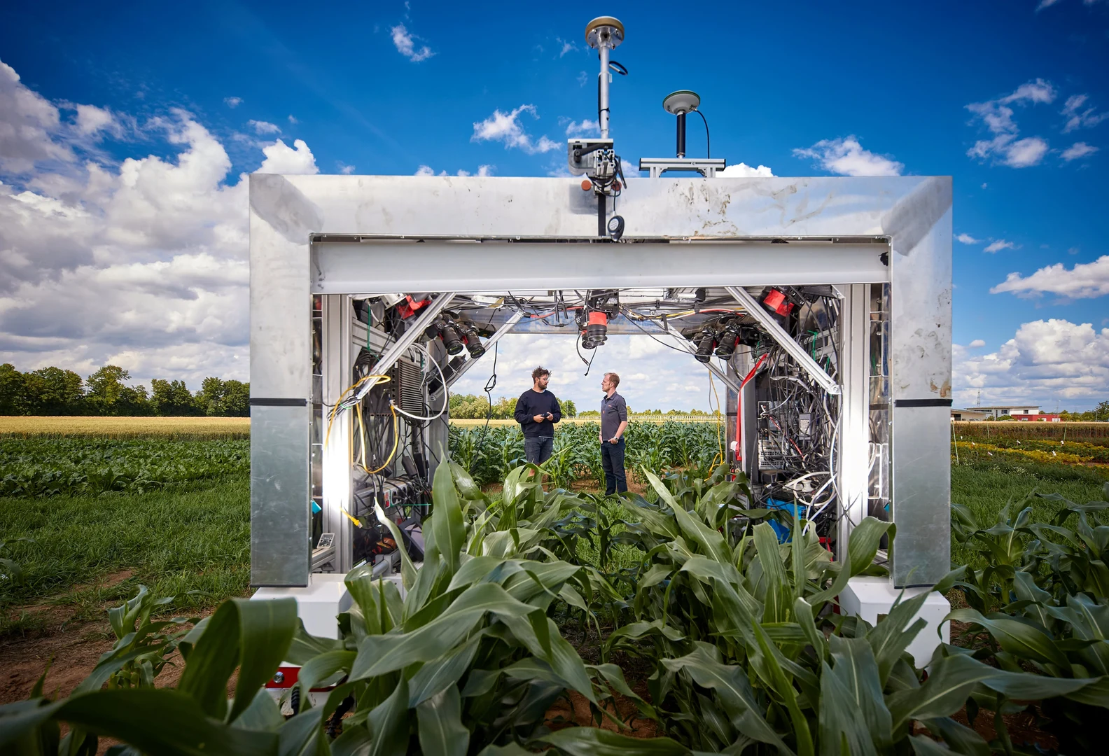
PhenoRob - Robotics and Phenotyping for Sustainable Crop Production (DFG Cluster of Excellence EXC-2070)
DFG Cluster of Excellence EXC-2070 (2019 – 2032)
Spokespersons: Prof. Dr.-Ing. Heiner Kuhlmann & Prof. Dr. Cyrill Stachniss
PhenoRob performs world-leading research in robotics and phenotyping for sustainable crop production. Our vision is to transform crop production by optimizing breeding and farming management through developing and deploying new technologies. PhenoRob addresses a real-world problem with a technology-oriented approach. Our scientists have backgrounds in computer science, geodesy, robotics, plant science, soil science, economics, and environmental science. This interdisciplinary team forms the only DFG-funded Cluster of Excellence focusing on agriculture.
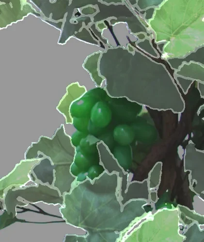
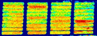
PhytoMo - Entwicklung von Monitoring Verfahren (Luft, Boden) zur Identifizierung von Phytoplasmosen in Weinbauflächen mit Blick auf den Quarantäne Schädling Flavescence dorée
BBMEL Vermeidung der Ein- und Verschleppung von geregelten und neuen Schadorganismen an Pflanzen (2021 – 2024)
Phytoplasmas, the causal agents of grapevine yellows diseases, are of great economic importance in viticulture. They are disseminated via contaminated propagation material and transmitted locally by phloemsucking leafhoppers. While Bois noir (BN) is widespread, Germany is currently considered free of Flavescence dorée (FD) and its vector Scaphoideus titanus. As a consequence of changing climatic conditions, the disease and its vector are extending their range to the north, directly threatening the Southern German wine-growing regions. The vector has been established in Alsace since 2016 and thus in close proximity to German wine-growing regions. Monitoring measures with regard to FD-infected vines and the vector S. titanus are therefore essential. New phytosanitary regulations require a systematic monitoring. Furthermore, intensive monitoring of vineyards is required as a preventive measure wherever S. titanus is present, since FD outbreaks can originate from single infected vines in the presence of this vector. Since FD phytoplasmas are derived from certain types of the 16SrV phytoplasmas widely distributed in native alders, it is assumed that few infections could be caused by occasional transmission of phytoplasmas from Alder.
The main objective of this project is to develop and test a monitoring procedure based on remote and proximal sensing methods for grapevine yellows. This monitoring procedure could supplement visual inspections in vineyards and propagation plots due to flexible application dates and high area coverage.
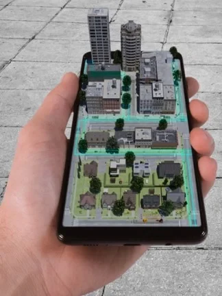
DeepView - AR-basiertes Assistenz- und Navigationssystem zur 3D-Visualisierung
der unterirdischen Infrastruktur
BMBF Mensch-Technik-Interaktion (2020 – 2022)
The visualization of data poses a major challenge in the civil engineering industry: Analog and non-standardized plans of underground infrastructure need to be accurately integrated and realistically represented before the start of construction. If this is not done with sufficient precision, serious damages such as supply failures or accidents may occur. To remedy this, a 3D assistance and navigation system based on "Augmented Reality" (AR) is to be developed, named "DeepView." With this new human-technology interaction, overall workflow steps can be shortened, simplified, and made safer. Generating a georeferenced database using conventional surveying technologies and the scientific evaluation of the developed AR system in terms of different accuracy requirements are key components of this project. Furthermore, the implementation of various approaches to georeferencing and sensor fusion is supported.

DeepUp - Vermessung 4.0
EXIST Startup Funding (2019 – 2020)
https://deepup.ai (Company Website)
Invisible and indispensable. Fiber optics, electricity, gas and water networks are the lifelines of every industrial nation, without which modern life would not be possible. Despite this, they are still treated in the same way today as they were 50 years ago. This leads to massive damage that directly affects not only our national economy, but also each and every one of us. DeepUp is revolutionizing the way we see and understand underground infrastructure – to enable us all to live safely and sustainably in a booming infrastructure world. DeepUp started as an EXIST-funded tech startup at Bonn University.
NoViSys - Novel viticulture systems for sustainable production and products
BmBF Innovative Pflanzenzüchtung im Anbausystem (2015 – 2020)
Fungus resistant new grape cultivars are the most recent innovation from grapevine breeding. They provide high quality wines and high resistance against the two mildew pathogens threatening viticulture. To expand planting of these cultivars would be the best strategy to reduce the enormous amount of sprayed fungicides in viticulture. Growing resistant cultivars with the novel cultivation method of the minimal pruning of trellis trained grapevines (MPTS) enables to combine (1) environmental friendly and (2) economically beneficial as well as (3) climate change adapted grapevine production. To analyze new resistant grapevine cultivars in such an advanced production system, we plan to evaluate the behavior of plants, crop, biodiversity, and resulting wines in comparison to the most common vertical shoot positioning in trellis-system (TS). We intend to unravel the cause of ripening delay upon viticultural treatments, and to develop the technological basis for a broad introduction of the new cultivation system into viticultural practice. Our comprehensive investigation will empirically and functionally address field studies where new cultivars are raised in a new cultivation concept. We will generate validated information for the wine growers to demonstrate benefits and risks. In addition the economical advantages as well as supporting marketing to improve consumer acceptance will be investigated. Our goal is to generate data and knowledge that will make viticulture more sustainable with regard to environmental, economic, and social aspects.
CropWatch - Informationssystem zur Prozesskontrolle und -analyse in der Pflanzenproduktion
BMEL (2016 – 2019)
Ziel ist die Entwicklung eines funktionsfähigen Demonstrators eines Informationssystems zur Kontrolle und Analyse des Pflanzenproduktionsprozesses. Es besteht im Wesentlichen aus einem serverbasierten Datenmanagementsystem mit integrierten Möglichkeiten zur Aufnahme, Speicherung, Prozessierung und Auswertung von Daten unterschiedlichster Herkunft aus dem Pflanzenproduktionsprozess. Es bedient sich zweier Digitalkameras, die an einem Traktoranbaugerät und an einem unbemannten Fluggerät montiert sind und während der Bewegung aus unterschiedlichen Höhen Bilder von Pflanzenbeständen liefern, und einer Wetterstation, die Standortspezifische Wetterdaten tagesaktuell ermittelt. Daten zu den Eigenschaften des Pflanzenstandortes, der Bewirtschaftung und der Ernteergebnisse werden vom Nutzer bereitstellt. Aus zeitlich und räumlich hoch aufgelösten Bildern werden geometrische und radiometrische Daten extrahiert und mittels neuer Algorithmen pflanzenproduktionsrelevante Vegetationsparameter abgeleitet, Informationen zu Pflanzenstandort, wachstumslimitierenden Witterungsszenarien, zum Pflanzenzustand und zur Ertragsbildung generiert sowie Analyseergebnisse webbasiert und nutzerbezogen visualisiert.
MoD - Mapping on Demand
DFG Research Unit FOR 1505 (2011 – 2017)
www.ipb.uni-bonn.de/projects/MoD
The goal of the research is the development and testing of procedures and algorithms for the fast three-dimensional identification and mensuration of inaccessible objects on the basis of a semantically specified user inquiry. The sensor platform is a lightweight autonomously flying drone. It uses the visual information from cameras for navigation, obstacle detection, exploration and object acquisition. The methods to be develop focus on the autonomous acquisition of probabilistic models to capture spatial-temporal patterns including semantics. The ability to cope with noisy sensor data and to explicitly represent the uncertainty is a central design element. The targeted approaches can be summarized with the term Mapping on Demand. This includes all processes, techniques, and tools to acquire the sensor data, to process and to interpret it with the goal of building a semantically annotated 3D model for the user. The user obtains the model on time and it supports his decision making process. Within the second phase, the research unit focuses on techniques for onboard execution and that are of incremental nature.