Facilities
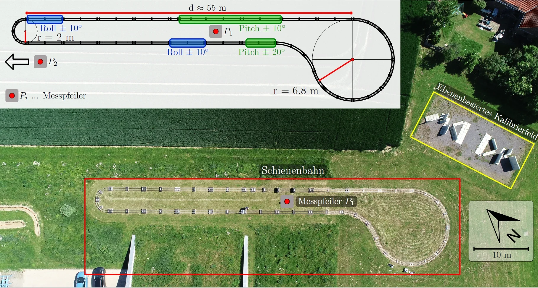
Rail-based Test Environment for Mobile Mapping Systems
It is about 140 m long and has variations in all six degrees of freedom, i.e. position and orientation. Several precisely positioned pillars are located in the vicinity of the rail track . They can be used to georeference target-tracking sensors such as total stations with sub-mm accuracy. With the help of a motorized rail car, a rail wagon mounting navigation sensors can be moved automatically along the rail track. This enables repeated kinematic measurements in several laps. The maximum speed of the rail car is 0.8 m/s.
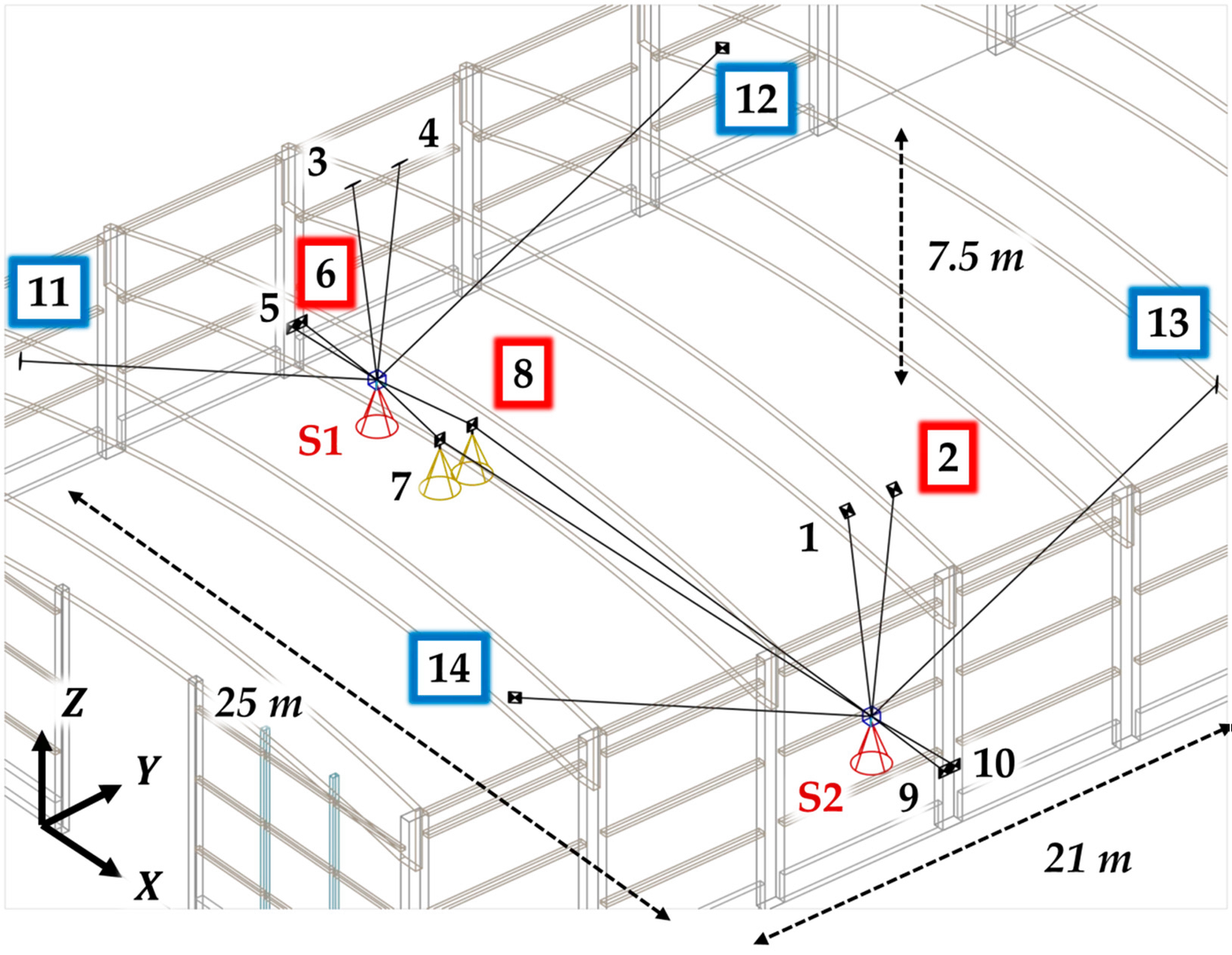
Calibration Field for Terrestrial Laser Scanner (TLS)
We developed a user-oriented, cost-efficient calibration field for panoramic terrestrial laser scanners. This calibration field delivers stable and reusable calibration parameters considering all relevant mechanical misalignments with predefined quality criteria. They reduce the measurement uncertainty without requiring instruments of higher accuracy. The geometry of the calibration field is optimized, that only 14 permanently installed targets have to be scanned from two defined scanner positions. Thus, a fast and precise calibration of panoramic terrestrial laser scanners is possible at any time.
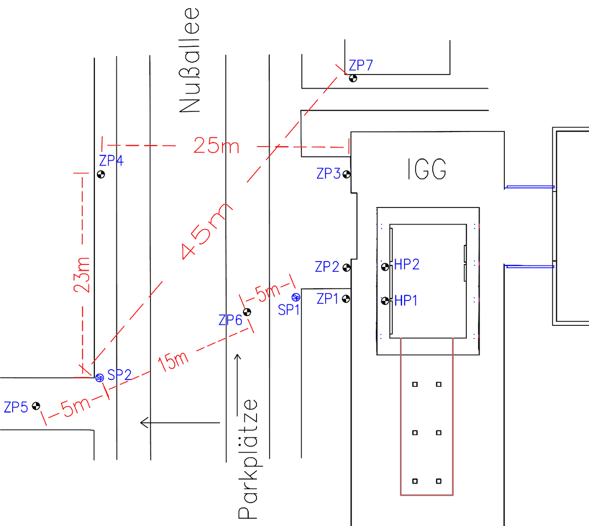
Test Field for Terrestrial Laser Scanner (TLS)
Terrestrial laser scanners are subject to systematic deviations due to internal misalignments. Regular inspection of these sensors is therefore unavoidable. For this reason, we operate our own permanently installed test field for terrestrial laser scanners consisting of two predefined scanner positions and several targets. The geometry is optimized so that the test field already reacts sensitively to small systematic deviations in the instrument. After only a short measurement time, it provides a statistically based statement if the laser scanner is operating within the accuracy specifications specified by the manufacturer.
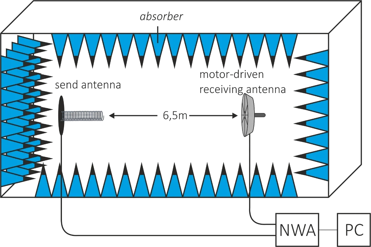
GNSS Antenna Measurement Chamber Bonn
A new procedure for the absolute calibration of GPS antennas has been developed at the IGG. The exact knowledge of the position of the electrical phase center relative to the antenna reference point is a prerequisite for increasing the accuracy of the relative positioning with GPS or GNSS methods in general. Although different calibration methods for determining the phase centers have already been developed, there is still a need for research, as there are still significant deviations in the results of different methods for the exact determination of the antenna centers and the treatment of the elevation and azimuth-dependent phase errors.
The aim is to improve the absolute calibration procedure to such an extent that it can be introduced as a calibration standard for GPS antennas.
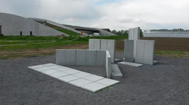
Calibration Field for Mobile Mapping Systems
We developed a calibration field and a procedure for mobile laser scanning system calibration, which is based on the following steps: An area with multiple concrete planes has been created, optimized for calibration purposes. The plane parameters have been determined using a terrestrial laser scanner. A point cloud of the calibration field is created with the system under calibration, using initial calibration values. By comparison of the resulting points with the reference planes the calibration parameters are estimated accurately using a least square approach